Aschia-Tinamou Fm
Type Locality and Naming
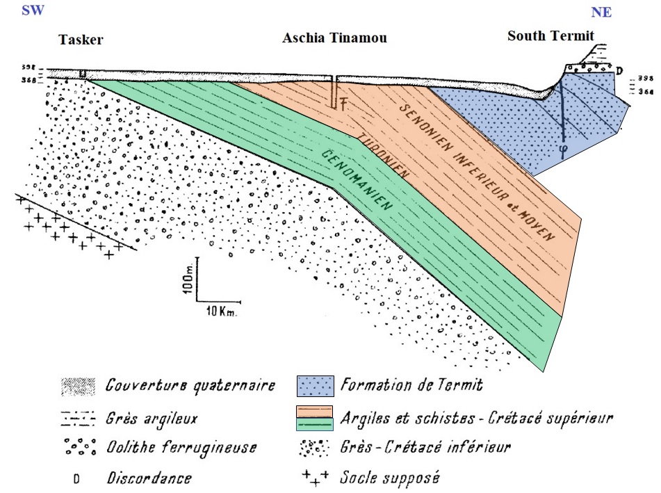
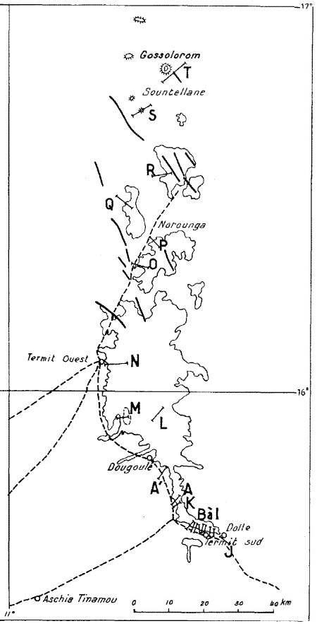
The Aschia Tinamou well SW of Termit Massif (Fig. 1; Fig. 2) Faure, 1966
[Figure 1: Hypothetic section showing the layers penetrated by the well at Aschia Tinamou (Faure, 1966, page 169). Green = Béréré Fm / Kandel Bouzou Fm ; Orange = Aschia-Tinamou Fm; Blue = Termit Fm]
[Figure 2: Location map of Termit Massif]
References: Faure, 1966; Fabre et al., 1983.
Synonym: Aschia Tinamou Fm. Equivalent(s): Yogou Fm & upper part of the Donga Fm in the Termit Graben
Lithology and Thickness
Green or black clays, dark shales and gray or yellow limestones. Gypsum, pyrite and fibrous calcite are abundant, as well as phosphate levels in fish debris. Faure (1966) states that the upper part of the Aschia-Tinamou Fm thickness is 170 m. On page 50, he says the whole formation is 300 m. The lower part of the Aschia-Tinamou Fm is, therefore, ~130 m.
Relationships and Distribution
Lower contact
Underlying unit is the Béréré Fm & Kandel Bouzou Fm
Upper contact
Overlying unit is the Termit Fm
Regional extent
East Niger Rift Basin - Termit Sub-Basin - West
GeoJSON
Fossils
The mollusc fauna is closely correlated with the Awgu Fm (Coniacian) in Nigeria. Fish, lamellibranchs, foraminifers, and ammonites (Tissotia species limited to West Africa, such as Tissotia latelobata Solger).
Age
Depositional setting
Marine
Additional Information
There is no outcrop of the Formation. All were determined from drill holes (Fig. 1).

